
Location: 1.175S, 136.102E
Data period: May 31, 2011 --
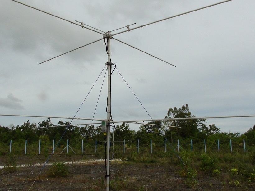
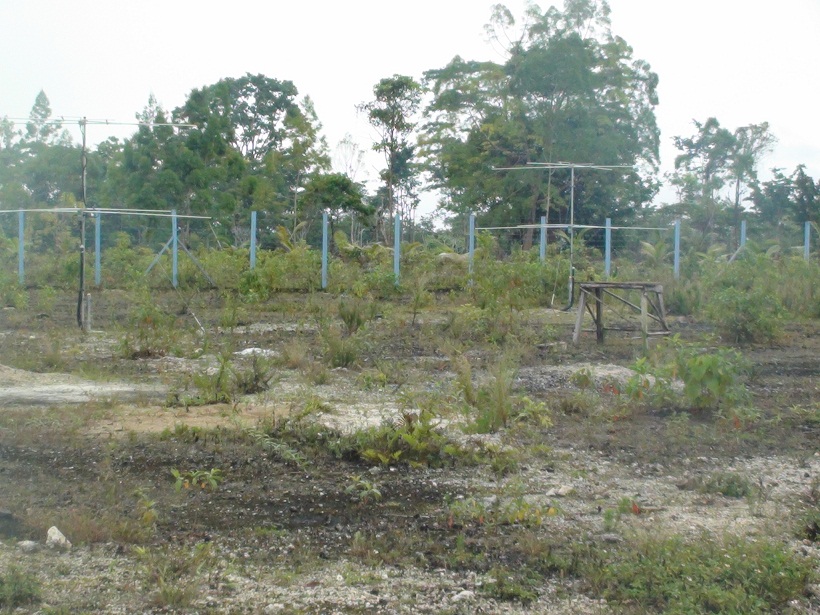
The original observation data of meteor trails and its radial velocity
in the mesosphere and lower thermosphere (70-110 km) taken by the meteor wind radar
at Biak, Indonesia (1.17S, 136.10E, 45m MSL). The data are stored in the text file
named mp(year)(month)(day).biak.mpd.
The lines 1-29 represent the file header which
contains the site location (latitude, longitude), height resolution, the number of
range gate number and radar status (operation frequency, antenna coordinate, record
length and phase offset etc.).
The line 30 is each parameter name (eDatef, eTimef, eFilef, eRgef, eHtf, eVradf,
edelVrf, eThetaf, ePhi0f, eAmbigf, eDelphasef, eant pairf, eIREX f, eamaxf, eTauf,
evmetf, and esnrdbf) while the lines 31 and below are date, time (universal time)
and observation data.
For detailed information, please refer to the
metadata .
The horizontal wind data in the mesosphere and lower thermosphere (70-110 km)
estimated from the meteor wind radar at Biak, Indonesia (1.17S, 136.10E, 45m MSL).
The wind data are calculated from the original observation data with a weighting
function. They are stored in the text file named Wb(year)(month).(resolution).txt
or Wb(year)(month)(day).(resolution).txt. The resolution abbreviations are
h2t60min00, h2t60min30, h4t60min00 and h4t60min30.
For example, the h2t60 means weighted average with Gaussian factors over +/-2 km
in height and +/-60 minutes in time. The min00 shows that the center of the Gaussian
window corresponds to 00 minute of every hour. The intervals of the wind data are
every 2 km and 60 minutes.
The text file includes year, day of year, time (universal time), height,
zonal and meridional winds, standard deviations of zonal and meridional winds,
number of meteor trails used to determine the horizontal wind and two internal
check values.
For detailed information, please refer to the
readme file (English, Japanese) and access the
metadata .
The horizontal wind data in the equatorial mesosphere and lower thermosphere
(70-110 km) estimated from the meteor wind radar observations at Biak, Indonesia
(1.17S, 136.10E, 45m MSL).
The wind data are calculated from the original observation data
with a weighting function. They are stored in the netCDF (network Common Data Form)
file named Wb(year)(month).(resolution).nc or Wb(year)(month)(day).(resolution).nc.
The resolution abbreviations are h2t60min00, h2t60min30, h4t60min00 and h4t60min30.
For example, the h2t60 means weighted average of the horizontal wind with Gaussian
factors over +/-2 km in height and +/-60 minutes in time. In this case,
the number of meteors stands for that of data points included in the height
and time window.
The min00 shows that the center of the Gaussian window corresponds to 00 minute
of every hour.
The intervals of the wind data are every 2 km and 60 minutes.
The netCDF file includes time, height, zonal and meridional winds,
standard deviations of zonal and meridional winds, and number of meteors.
For detailed information, please refer to the
readme file (English, Japanese) and
access the
metadata .
The time-height plot of horizontal wind data in the mesosphere and lower
thermosphere (70-110 km) estimated from the meteor wind radar at Biak, Indonesia
(1.17S, 136.10E, 45m MSL). File names are composed of date and variable abbreviation: Wb(year)(month)(day).(resolution).gif (daily plot), Wb(year)(month).(resolution).gif (monthly plot) and Wb(year).(resolution).gif (yearly plot). The resolution abbreviations are h2t60min00, h2t60min30, h4t60min00 and h4t60min30 (please refer to the metadata of text or netCDF data for details of the resolution abbreviations). These plots are made using the netCDF data of each resolution in time and height. For yearly plot, only the h2t60min00 and h4t60min00 data are used and averaged for each day. The daily average is done if there are more than one valid data in all of the four time zones (0-5, 6-11, 12-17 and 18-24 h).
If you want to know more information of this data,
please refer to the
readme file (English,
Japanese), and access the
metadata .
| Year |
h2t60min00 |
h2t60min30 |
h4t60min00 |
h4t60min30 |
| 2011 |
1-day,
1-month |
1-day,
1-month |
1-day,
1-month |
1-day,
1-month |
| 2012 |
1-day,
1-month |
1-day,
1-month |
1-day,
1-month |
1-day,
1-month |
| 2013 |
1-day,
1-month |
1-day,
1-month |
1-day,
1-month |
1-day,
1-month |
| 2014 |
1-day,
1-month |
1-day,
1-month |
1-day,
1-month |
1-day,
1-month |
| 2015 |
1-day,
1-month |
1-day,
1-month |
1-day,
1-month |
1-day,
1-month |
| 2016 |
1-day,
1-month |
1-day,
1-month |
1-day,
1-month |
1-day,
1-month |
| 2017 |
1-day,
1-month |
1-day,
1-month |
1-day,
1-month |
1-day,
1-month |
Created: Tue Sep 03 04:01:20 +0900 2019
RISH Metadata Management Group
Research Institute for Sustainable Humanosphere (RISH), Kyoto University
Gokasho, Uji, Kyoto 611-0011, Japan
E-mail: iugonet (at) rish.kyoto-u.ac.jp